
Case Study · Mining · Milford, Utah
Milford: A Century of Mining Records in One 3D Model
How Pryzma brought every public survey, historical report and company record for an open-pit copper mine near Milford, Beaver County, Utah, into one checked 3D district model where every figure traces to its source page.
- Sources catalogued
- 312
- Pages searchable, cited by page
- 3,936
- Drill holes reconciled
- 2,000+
- Historical workings placed in 3D
- 870
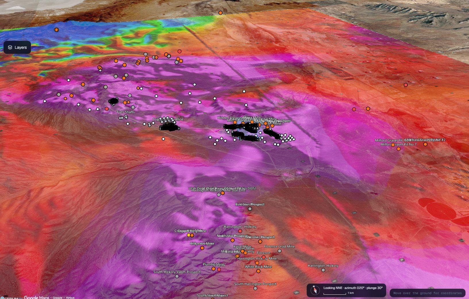
Pryzma District Explorer: USGS Earth MRI magnetics (reduced to pole) draped on 3D terrain across the Milford district, with historical mines and drill collars.
The Site
Milford, Beaver County, Utah.
The Milford district lies in southwest Utah, west of the town of Milford, where the Rocky Range and the San Francisco Mountains rise out of the Escalante Valley at the eastern edge of the Great Basin. Prospectors worked the ranges from the 1870s, and the Horn Silver mine at Frisco was among the richest silver mines of its day.
The ore sits in skarns, where quartz monzonite intruded Paleozoic limestone and dolomite. Copper has been mined from these skarns for more than a century, and in 1941–43 the Old Hickory mine shipped tungsten for the war effort. The US Geological Survey mapped the workings in 1913 and returned in the 1940s to study the tungsten.
Today an open-pit copper mine and processing plant in the district produces copper cathode. Its records span every one of those eras, and that history is what Pryzma was asked to put to work.
Location
Milford mining district, Beaver County, southwest Utah
Setting
Rocky Range and San Francisco Mountains, eastern Great Basin
Operation
Open-pit copper mine and processing plant producing copper cathode
Geology
Copper and tungsten skarns where quartz monzonite intrudes Paleozoic limestone
The Challenge
A hundred years of data. Mixed datums. No single source of truth.
More than a century of records in different hands: USGS survey plates from 1913, 1940s strategic-minerals bulletins on the district's wartime tungsten, decades of drilling by successive owners, and a modern NI 43-101 technical report. Most of it was scanned paper, unindexed and spread across drives and binders.
Mixed coordinate systems. Historical data sits in NAD27, NAD83, local mine grids and Utah state-plane feet, with elevations in NGVD 29 or NAVD 88. At this property, one wrong datum assumption moves a drill hole by up to 215 m.
Historical drill holes listed in reports but never entered into any database, and legacy databases built for earlier owners in formats nobody had checked since.
Public data scattered across a dozen portals: USGS and Earth MRI geophysics, state geologic maps, BLM land records, Utah mine permits, water-well logs and core-library holdings, each in its own format.
Figures copied between documents drift from their source. Tonnages, grades and units (short tons against metric tonnes) had to be traced back to the page they came from before anyone relied on them.
Company data had to stay private: isolated from every other tenant, marked on every record, and exported only through an audited path.
What Pryzma Built
A district intelligence platform: every record searchable, mapped and checked.
District Explorer: The District in 3D
A 3D globe on Google Photorealistic 3D Tiles with 68 switchable map layers: geology, magnetics, gravity, radiometrics, land status, mines and imagery. Drill holes draw underground at true depth, coloured by logged rock or by source.
Underground View and Slices
Open the ground anywhere to see shafts, adits and tunnel levels placed from the 1913 survey plates and later reports. Draw a line and Pryzma cuts a section along it, with the geological model on the face and a key to every unit.
Geo-Reference Reconciliation
Every coordinate is stored exactly as published, with its datum and units, then transformed with PROJ and the NGS grids (NADCON5, GEOID18) into NAD83(2011) UTM zone 12N. Features that appear in several sources are matched, and offsets beyond tolerance are flagged for review.
Page-Cited Search
Every page of every report, filing, thesis and map is OCR'd and indexed for exact terms and for meaning. Each hit names the document and the page, so a figure can be checked against its source in one click.
Source Catalogue and Drill Model
Each source carries its publisher, datum and SHA-256 checksum, and records still to get (fees, records requests) are tracked as tasks. Drill holes load into standard collar, survey and interval tables and export to Leapfrog as OMF, GOCAD, DXF or CSV.
CUI-Capable by Design
A dedicated tenant with MFA sign-in, markings on every record and an export ledger, behind a US-only firewall with FIPS-validated TLS. Architected for NIST SP 800-171 and CMMC Level 2, with a System Security Plan and POA&M drafted, and deployable to AWS GovCloud (US) if a defense award requires it.
Inside District Explorer
Screens from the Milford build.
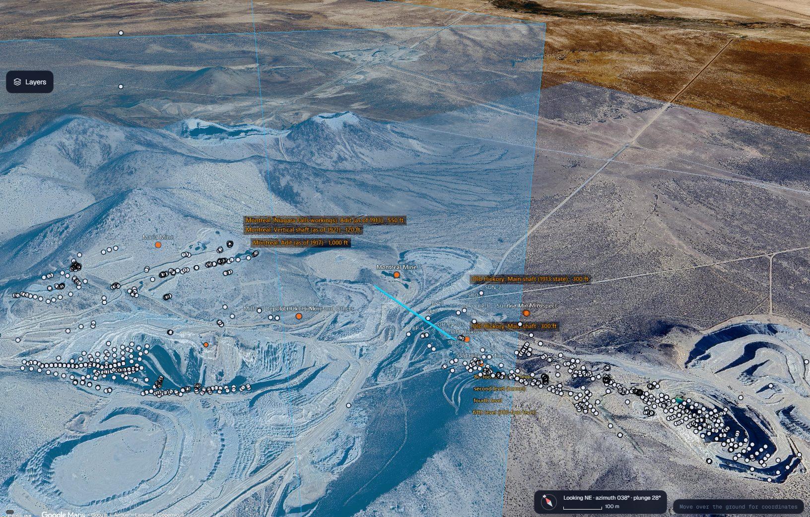
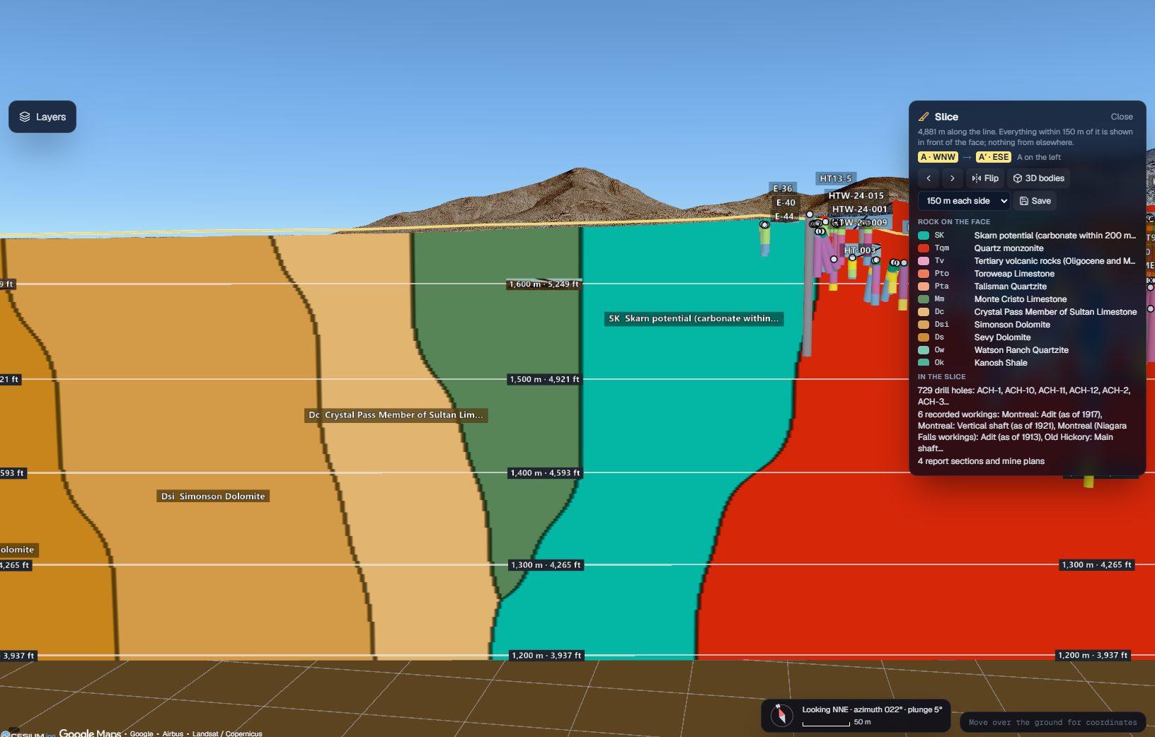
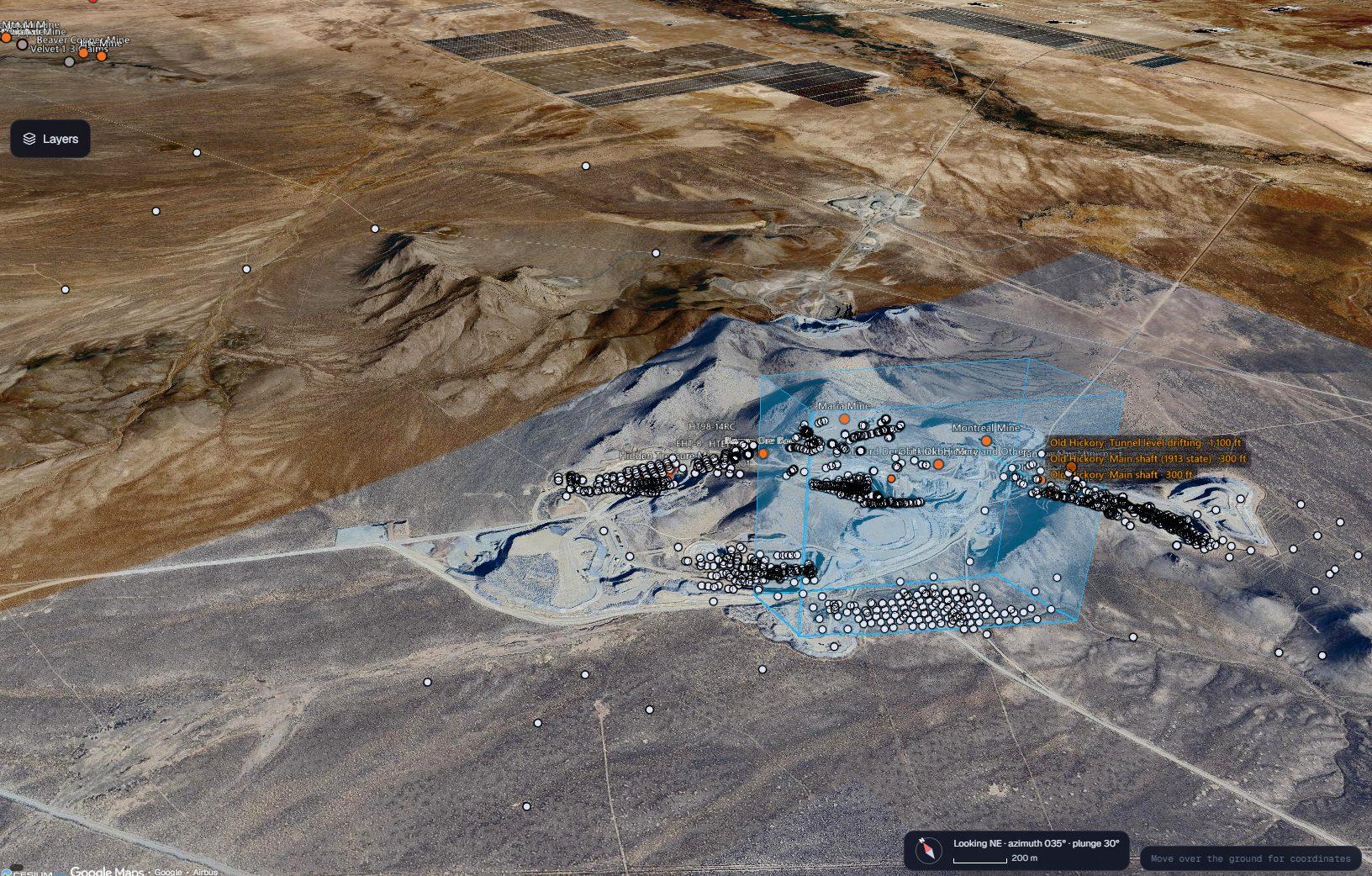
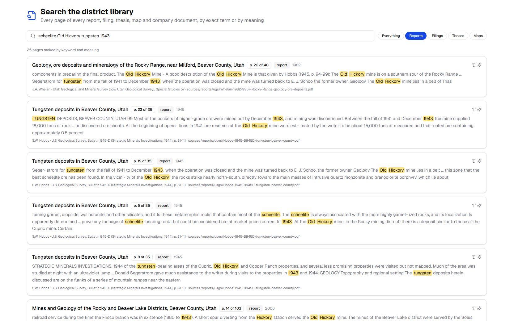
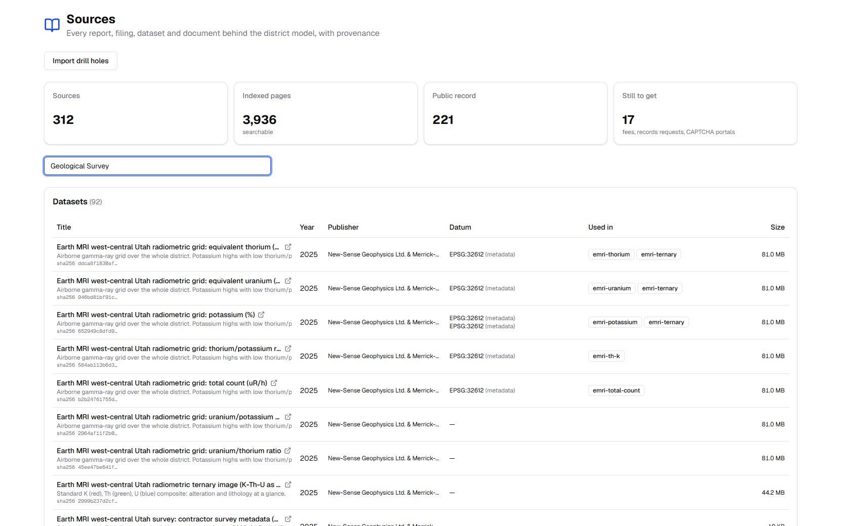
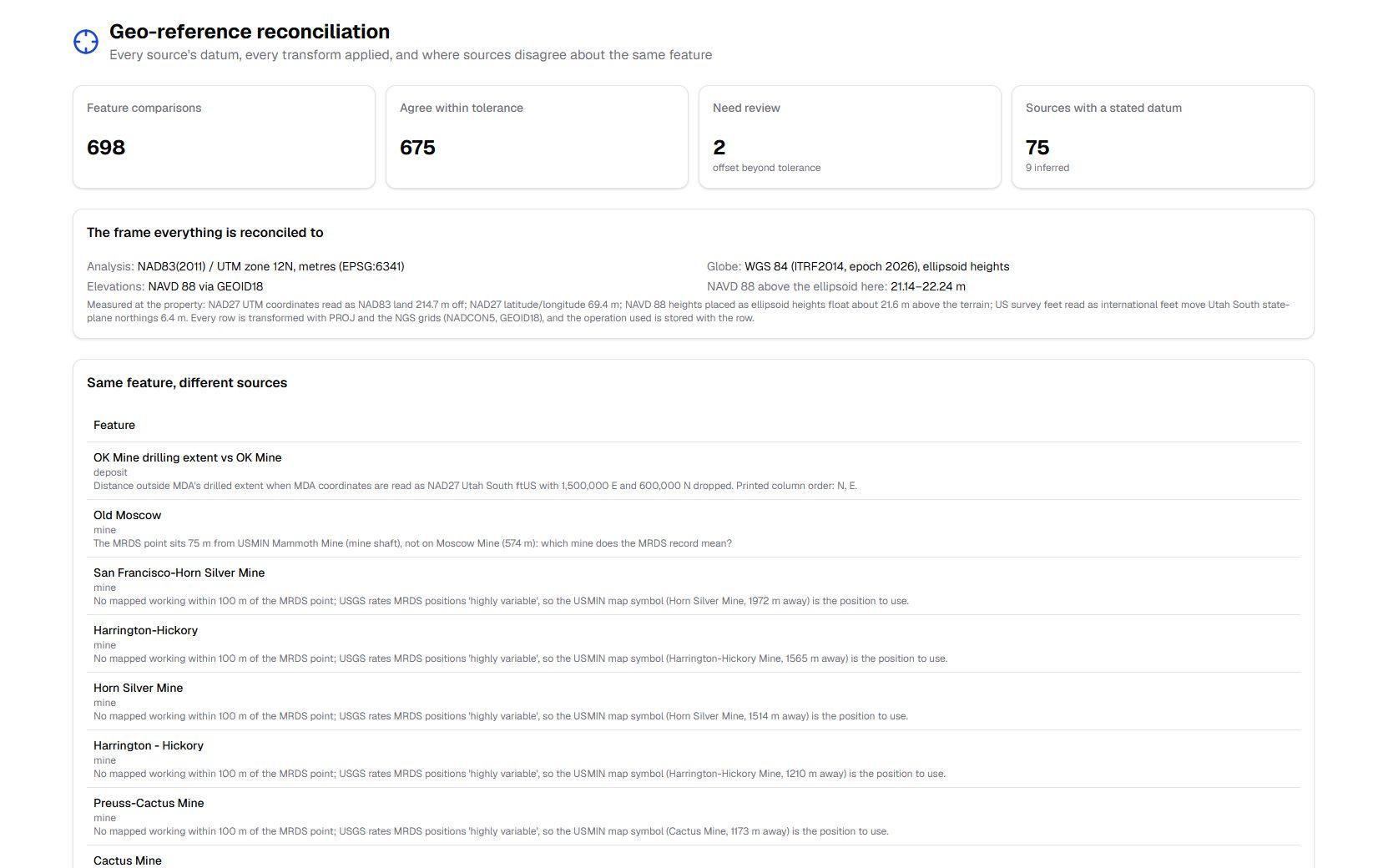
Screens show public data only (USGS, Utah Geological Survey and state records). Company assays, targets, land and financial data are omitted.
Data Coverage
Every public layer. Every company record. One frame.
Geophysics
USGS aeromagnetics, Bouguer and isostatic gravity
Earth MRI
2023–24 airborne magnetics and radiometrics
Geology
USGS state compilation, 1:48,000 quadrangles, faults
Mines & Occurrences
USGS MRDS and USMIN, UGS UMOS
Historical Reports
1913 USGS plates, 1945 tungsten bulletin, UGS studies
Land
BLM claims and surface status, Utah SITLA, PLSS
State Records
Utah DOGM permits, water-well logs, UGS core center
Terrain & Imagery
USGS 3DEP elevation, Sentinel-2, Google 3D tiles
Drilling
2,000+ holes with collars, surveys and logs
Company Records
Technical reports, mine plans, as-built surveys
Results
Every number traceable. Every position reconciled.
3,936
Pages searchable by term and by meaning, every hit cited to document and page
698
Cross-source position checks: 675 agree within tolerance, and the rest are flagged with the reason
215 m
Position error from one wrong datum assumption at this property, now prevented by a transform recorded on every row
316
Historical drill holes listed in reports but never databased, recovered and placed in the model
14 of 14
Drill intercepts reproduced exactly by an independent recompute before any result was shown
870
Historical shafts, adits, workings and report sections placed underground at true depth
Under the Hood
How the district model is built.
Data Pipeline
What Goes Wrong Without Reconciliation, Measured at Milford
Computed with PROJ 9.5 and the NGS grids at the property (38.47° N, 113.05° W). Old drill logs often stack several of these errors at once.
Models That Report Their Own Limits
Every predictive layer is scored blind on drill holes it never saw. Near existing drilling, the geology model calls the logged rock type correctly 65.5% of the time, against a ceiling of about 70% set by twin holes. Far from drilling it says so, and the platform ranks new holes by how much each one would teach, not only by its odds. Pryzma prepares and checks the evidence; sign-off stays with the Qualified Person.
Sitting on a century of district records?
Scanned reports, legacy drill databases, mixed datums. Pryzma turns them into one district model you can search, see in 3D and check.